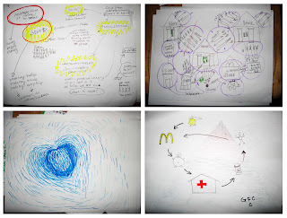
A stack of monochrome marker drawings, with a common motif of stick figures linked by arrows to “$” icons and symbols of economic hardship: a boarded-up art gallery announcing “For Rent”; elsewhere, under a list titled “Basekamp costs”, the stratagem “Steal materials from construction sites.” These drawings were the fruit of a 2-hour workshop held at Basekamp this past Saturday. It followed the opening of An Atlas, an exhibit of “radical cartography” that compliments a two-volume publication of essays matched to artist-made maps.
Different approaches to the assignment “map the global economic crisis”
The workshop kicked off a global tour; Lize Mogel [pronounced ‘Lizzy’], who co-curated the exhibit, heads next to Utrecht The assignment: draw a map of the global financial crisis, with yourself in the middle. Lize collects the resultant drawings – “a public archive of maps” – and will then re-interpret them, finding patterns, making a meta-map. A fertile mix of artists and non-artists were in attendance at Basekamp. One young-ish man who didn’t fit any artistic stereotypes programmed computers for a map company; he showed up because his boss had passed him an email. Knowing that Basekamp endorsed Marxist tenets, I was able to pick out the maps made by co-founder David Dempewolf. His stick figures centered around the text-bubble “CAPITALISM -FUELD CONSUMERISM GONE WILD.” Everyone found the exercise nearly therapeutic. Mary-Ruth Walsh, a Dubliner currently in residence at Basekamp, commented, “making maps to work through a particular problem – it’s a methodology I would use in my practice.”
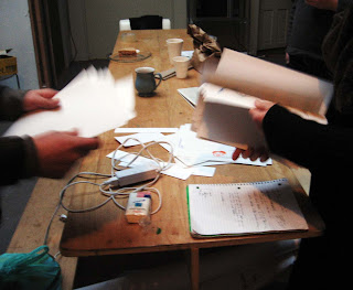
Sorting through the finished maps
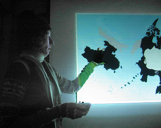
Lize followed the workshop with a lecture that interwove the past 10 years of her own practice with a millennium-spanning history lesson on maps. Her cartographic bug, she explained, developed out of an interest landscapes. She began her slideshow from this purely aesthetic approach, paging through her images shot from airplane windows — “Here, I was just interested in patterns.” Then, we saw in situ images of “Public Green,” a heavily annotated schematic map of Los Angeles parks that was printed for hundreds of bus stops and invited close reading. Lize would be the first to admit that, like all maps, this one was ideological. It encouraged the low-income bus-riding demographic to utilize parks. (How does a young artist get exposure on ad space which mostly promotes movies to passing cars? Only by chance: Lize happened to meet a ClearChannel exec.)
From the L.A. region, Lize’s focus grew to encompass the world. On common maps, she explained, geometric distortions enlarge and center the west (or what the astute call “the global north”). To flatten the globe onto paper is to ‘project’ it; “my favorite projection,” Lize told us, “is the azimuthal…” The azimuthal? Yes; it places the North Pole squarely at the center, and became the emblem of the United Nations because of its egalitarian depiction of the continents. Lize’s 2008 piece ‘Area of Detail’ zooms in on that central void and denotes shrinking ice boundaries and currently contested national boundaries. (Remember when Russia planted a flag on the ocean floor several summers back?) The sharply designed map was printed on a rotating table top; on the wall adjacent, neatly arranged correspondence between national governments and the UN Commission on Limits to the Continental Shelf regarding of oceanic rights. “If you’re me,” she said, “it’s hilarious.”
My favorite work, however, is Lize’s series (one of which is included in the current exhibition) of stark black-on-white forms, like a Rorschach but less chaotic. They represent the contours of shipping ports and other nodes in the flow of trade, traced from aerial imagery: visual distillations of globalization. Nearly all of the work on display exudes graphic design professionality. The only piece with painterly quality is Pedro Lasch’s “Latino/a America,” a reproduction of series of red maps which traveled across the Mexican boarder in the pockets or luggage of a particular person – each faded and worn differently, all beautiful.
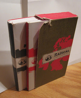
To my disappointment, each piece in “An Atlas” is a crisp, computer-printed image on beautiful matte paper. The exhibit has been traveling, with modifications, since summer 2007, hence the expediency of doing without originals, and the project’s raison d’etre is really the published volume. Still, wouldn’t it be more fulfilling if original drawings traveled from city to city? Only Lize’s personal copy of Radical Cartography had this art-object aura. She passed it around after the talk. Its ragged condition, I first assumed, was an affect from the publisher, like “distressed” jeans, but no – this was Lize’s, and, like Lash’s piece, it has accompanied her on many travels.
Basekamp is at 7th & Chestnut, and the exhibit runs into March. They’ll be open First Friday in February. The companion volume ‘Radical Cartography’ can be purchased there, or online. (And if you’re an artist looking to live collectively and cheaply in Center City, inquire within.)


